Ever seen a world map turned upside down? An inverted world map fundamentally challenges our traditional perceptions of geography and global hierarchy. This fascinating cartographic concept flips the Southern Hemisphere to the top, literally turning our conventional understanding of north and south on its head. It is more than just a novelty; it is a powerful tool for prompting critical thinking about cultural biases in mapmaking and how these influence our worldview. Exploring an inverted map can offer a fresh, thought-provoking perspective on international relations, climate discussions, and even everyday navigation. Many in the United States find this alternative view both disorienting and enlightening, sparking important conversations about perspective. This approach encourages us to question long-held assumptions about the world's layout.
Is an inverted world map factually correct?
An inverted world map is factually correct in terms of geographical positions and relative distances. It simply presents the Earth's continents and oceans rotated 180 degrees. The landmasses and their relationships remain accurate. It is a matter of perspective, not a distortion of geographical truth. It offers a different visual interpretation.What is the point of an upside down map?
The point of an upside down map is to challenge geographical biases and traditional Northern Hemisphere-centric views. It encourages critical thinking about how maps are made and how they influence our worldview. It aims to foster a more inclusive and balanced global perspective, highlighting the arbitrary nature of 'up' on Earth.Are there any disadvantages to using an inverted world map?
While valuable for perspective, a disadvantage of an inverted world map is its unfamiliarity, which can initially disorient users accustomed to traditional orientations. This might make quick navigation or conventional geographical referencing challenging. However, this initial discomfort is often part of its educational purpose.Why do Australians sometimes use inverted maps?
Australians sometimes use inverted maps to emphasize their unique Southern Hemisphere perspective. It's a playful yet profound way to challenge the Eurocentric bias in cartography and assert their position on the globe. This 'south-up' view helps foster a sense of national identity and global significance. It literally puts Australia on top.How do inverted maps impact cultural understanding?
Inverted maps significantly impact cultural understanding by visually de-centering traditionally dominant regions. They encourage viewers to see the world from a different cultural vantage point, potentially fostering greater empathy and reducing ethnocentric biases. This shift can lead to deeper appreciation for diverse global cultures and their contributions.Are inverted maps used for navigation?
Inverted maps are generally not used for practical navigation due to their unconventional orientation. Most navigational tools, charts, and GPS systems adhere to the standard north-up convention for consistency and ease of use. Their primary role is educational and conceptual, challenging perspectives rather than guiding journeys.Have you ever paused to consider why North is always at the top of a world map? The concept of a world map inverted challenges this long-held convention, literally turning our global perspective on its head. This powerful visual tool makes us question the biases inherent in traditional mapmaking. It forces us to reconsider geographical relationships and our place within the global community.
An inverted world map simply places the Southern Hemisphere at the top. It rotates the entire Earth's depiction by 180 degrees. This seemingly minor change can profoundly impact how we perceive continents. It redefines our understanding of global power dynamics and cultural significance. For many, seeing the world this way can be quite a revelation.
The Power of an Inverted World Map Perspective
Exploring an inverted world map offers a unique educational opportunity. It helps people in the United States and beyond understand cartographic projections more deeply. This alternative view prompts discussions about Eurocentrism and Northern Hemisphere dominance in historical mapmaking. It encourages a more balanced and inclusive understanding of our planet's diverse regions.
Why Do We Need an Inverted World Map?
We often assume that 'up' means 'north' due to historical map conventions. An inverted world map reminds us that on a sphere, there is no inherent up or down. This map encourages a less biased, more open-minded approach to geography. It fosters a deeper appreciation for diverse global perspectives.
Impact of an Inverted World Map on Education
Educators frequently use an inverted world map to spark critical thinking in students. It helps them understand the arbitrary nature of map orientations and the cultural influences behind them. This can lead to richer discussions about geopolitics and global interconnectedness. It broadens their geographical literacy significantly.
What Others Are Asking?
Is an inverted world map more accurate?
An inverted world map is not inherently more or less accurate than a conventional one regarding continental shapes or sizes. Accuracy depends on the projection method used, not its orientation. It simply presents the same geographical data from a different visual perspective, challenging traditional views. The physical distances remain consistent.
Where can I buy an inverted world map?
Many online retailers specializing in maps, educational supplies, or unique home decor offer inverted world maps. Websites like Amazon, Etsy, and specialty cartography stores often stock various designs and sizes. You can also find digital versions for display or educational purposes. They are becoming more popular.
What is the purpose of an inverted world map?
The primary purpose of an inverted world map is to challenge geographical biases and promote alternative perspectives. It encourages viewers to question the conventional Northern Hemisphere-centric view, fostering a more balanced understanding of global relationships. It serves as an excellent educational tool for critical thinking and cultural awareness. It is a powerful conversation starter.
Do other countries use inverted maps?
While not standard, some countries, particularly in the Southern Hemisphere like Australia, have occasionally produced and used inverted maps. These 'south-up' maps reflect a localized perspective. They emphasize their region's position at the top, challenging the historical dominance of northern-centric cartography. It is a statement of identity.
How does an inverted map change perception?
An inverted map profoundly changes perception by making familiar continents appear unfamiliar. It can highlight the global south as central, rather than peripheral. This shift can alter our understanding of power dynamics, resource distribution, and cultural significance, prompting new insights into international relations and global connectivity. It offers a fresh mental model.
FAQ about the World Map Inverted
Who uses a world map inverted?
A world map inverted is primarily used by educators, cartographers, and individuals seeking to challenge conventional perspectives. It appeals to anyone interested in cultural studies, global awareness, and breaking free from traditional geographical biases. It is a tool for intellectual exploration.
What is the world map inverted?
The world map inverted is a cartographic representation of Earth where the Southern Hemisphere is positioned at the top. This 180-degree rotation of the standard map challenges the traditional 'north-up' orientation. It offers an alternative visual interpretation of our planet's geography. It is essentially a flipped map.
Why is the world map inverted important?
The world map inverted is important because it exposes and challenges inherent biases in traditional mapmaking. It promotes critical thinking about geographical power structures and cultural perspectives. It encourages viewers to reconsider their assumptions about global centrality and peripheral regions, fostering broader understanding. It sparks vital dialogue.
How does the world map inverted influence global understanding?
The world map inverted influences global understanding by offering a fresh viewpoint that de-centers the Northern Hemisphere. This shift can lead to increased empathy and awareness for countries in the global south. It encourages a more equitable perception of international affairs and cultural significance. It broadens our geographical horizons.
Understanding the World Map Inverted
| Feature | Traditional World Map | Inverted World Map |
|---|---|---|
| Orientation | North at top | South at top |
| Common Perception | Northern Hemisphere as dominant | Southern Hemisphere as dominant or central |
| Educational Value | Standard geographical reference | Challenges biases, promotes critical thinking |
| Visual Impact | Familiar, conventional | Unfamiliar, thought-provoking |
| Cultural Context | Often Eurocentric/North-centric | Decentralizes traditional centers |
The discussion around a world map inverted is truly about perspective. It is about understanding that our perceptions are often shaped by the way information is presented to us. By simply flipping a map, we open ourselves to new ways of thinking. This simple act can transform how we view our interconnected world.
The World Map Inverted: A Fresh Take for 2026
In 2026, the conversation around diverse perspectives continues to grow. The world map inverted offers a powerful visual metaphor for this ongoing dialogue. It encourages us to look beyond established norms and embrace new viewpoints. This map is not just about geography; it is about challenging our mental maps of the world.
So next time you encounter a world map, take a moment. Imagine it inverted. What new insights might emerge? How does this simple shift in perspective change your understanding of our shared planet? Embracing such views can enrich our understanding and foster a more inclusive global outlook.
An inverted world map flips the traditional north-south orientation, placing the Southern Hemisphere at the top. This shift challenges established geographical biases and promotes a fresh perspective on global relationships. It highlights the arbitrary nature of 'up' on a spherical Earth, encouraging critical thought. Such maps are often used in educational settings to broaden understanding. They invite viewers to reconsider cartographic conventions. The experience can be both disorienting and highly enlightening.
 EPCOT Map Walt Disney World Screenshot At .. PM
 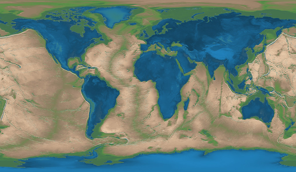 Inverted World Map Vivid Maps fcbffc B
 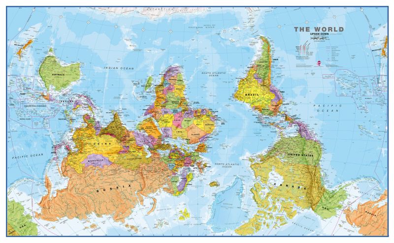 Buy Upside Down World Map World Wall Map Upside Down World Wall Map Political Without Flags Wm
 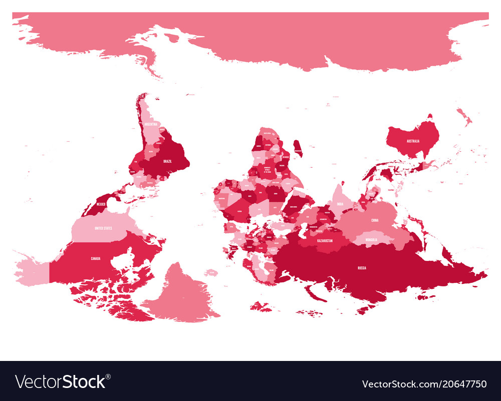 Reversed Or Upside Down Political Map Of World Vector Image Reversed Or Upside Down Political Map Of World Vector
  Reversed Or Upside Down Political Map Of World Vector Image Reversed Or Upside Down Political Map Of World Vector
  Azimuthal World Map Inverted D Model By
 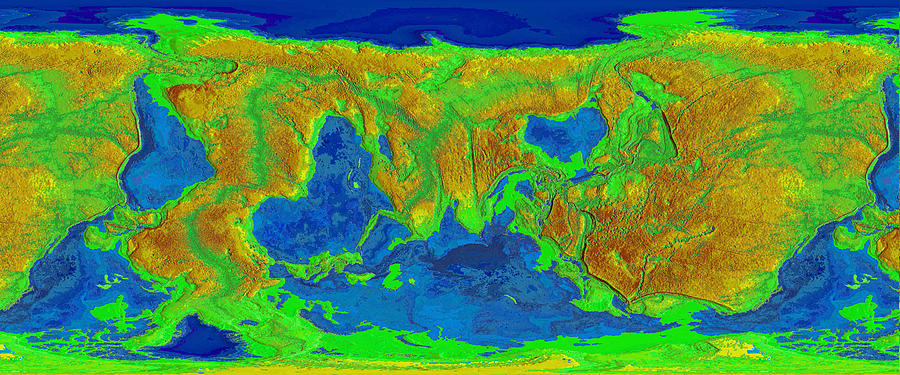 Inverted Elevation World Map Digital Art By Massimo Pangaea Pietrobon Inverted Elevation World Map Massimo Pangaea Pietrobon
  Total Solar Eclipse Iceland BusTravel Iceland Total Solar Eclipse Totality Path Map x
  World Map Inverted Circle Black Stock Download Image Now World Map Inverted Circle Black
  The Economist Group The Economist Launches The World Ahead With TWA Cover x
  Interactive Map Year R